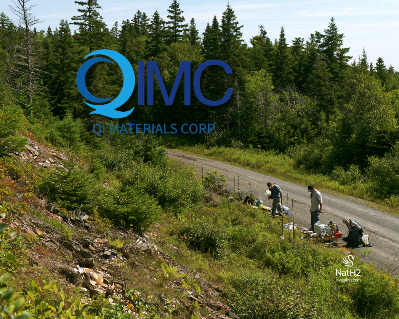
QIMC Defines Three Helium Anomaly Zones and Expands Nova Scotia Seismic Program to 50 Kilometres
Québec Innovative Materials Corp. has defined three priority helium soil-gas anomaly zones in the New Salem-Apple River area of Nova Scotia’s Cumberland Basin, prompting the company to expand its planned 2D seismic program by approximately 8.5 line-kilometres to directly investigate the new targets.
The results come from a 526-sample soil-gas program conducted across 28 lines during 2026 and independently analyzed by GeoFrontiers Corporation in Texas. The campaign expands QIMC’s helium database in the district from just 28 samples to 554 and provides the company with its first statistically defined regional helium background and anomaly thresholds.
QIMC calculated a regional background of 5.40 ppmv helium and an anomaly threshold of 5.48 ppmv. Of the 526 new samples, 463 were classified as background, 63 as anomalous and 18 as strongly anomalous above 5.57 ppmv.
The strongest results occur in Zone C, where line 5002 returned a peak of 5.864 ppmv helium, the highest concentration recorded in the program.
Seventeen of the 25 stations along that line exceeded the anomaly threshold, including an uninterrupted 800-metre sequence of anomalous sampling stations. The lateral consistency of those readings has made Zone C a priority for both closer-spaced geochemical sampling and dedicated seismic coverage.
Approximately four kilometres west, Zone B contains another coherent anomaly along the same east-west regional structure, identified as fault F-III.
There, line 5000 returned an approximately 1.5-kilometre anomalous segment with helium concentrations reaching 5.690 ppmv.
The third main target, Zone A, incorporates QIMC’s original November 2025 New Salem traverse. That earlier 28-station survey returned helium concentrations as high as 5.722 ppmv together with thermogenic hydrocarbons and has now been interpreted as lying along regional fault F-I, approximately three to seven kilometres southwest of Zones B and C.
A fourth area is also emerging.
QIMC reported a sharp 5.831 ppmv helium peak at Zone D on line 6002, associated with fault F-II on the Apple River side of the exploration grid. The company is treating the location as an additional target while further work continues.
The broader statistical relationship between the helium readings and mapped faults is central to QIMC’s interpretation.
Across the full dataset, anomalous helium stations were approximately five times more common within 1.5 kilometres of a mapped fault than at distances greater than two kilometres, with frequencies of 17% and 3%, respectively. QIMC reports that relationship as statistically significant at p < 10⁻⁸.
The company interprets the association as evidence that regional structures are influencing the migration of deep-sourced gases toward the surface.
Helium is chemically inert and can be generated through radioactive decay in crustal rocks. Because it can migrate through fractures and faults, soil-gas helium is commonly used as a tracer of subsurface fluid pathways.
QIMC is applying that concept at New Salem-Apple River to identify areas where mapped faults coincide with elevated surface helium.
The interpretation is particularly relevant to the company’s broader Cumberland Basin exploration model, which is targeting multiple naturally occurring gases rather than helium in isolation.
QIMC has previously identified natural hydrogen farther along the Apple River-Bennett Hill corridor, while its 2025 New Salem sampling returned thermogenic hydrocarbons alongside helium. The company is investigating whether the same regional structural architecture provides migration pathways for different gases generated or accumulated within the basin.
That does not establish that the helium anomalies represent subsurface reservoirs. Soil-gas measurements identify near-surface geochemical variations, and even consecutive anomalous stations cannot determine the concentration, pressure, volume or deliverability of gas underground.
The next exploration stage is therefore designed to connect the surface geochemistry with subsurface structure.
QIMC has expanded its previously announced Nova Scotia 2D seismic campaign from approximately 42 line-kilometres to approximately 50 line-kilometres, adding about 8.5 kilometres specifically in response to the new helium results.
The revised survey has been designed with Echo Seismic and Strum Consulting so that every helium anomaly zone identified by the current program will be crossed by at least one seismic line.
Line 4 will cross all three New Salem regional faults through Zones A and B, while QIMC has added a dedicated north-south seismic segment across Zone C to directly investigate the structure beneath the strongest helium anomaly.
Additional seismic coverage will also tie the Zone B segment and Zone D peak to subsurface fault geometry and potential structural closures.
That integration creates a straightforward targeting test.
If a coherent surface helium anomaly coincides with a fault or structural closure independently mapped by seismic, QIMC would have two separate datasets supporting the same exploration target.
The company is also increasing sampling resolution before drilling decisions are made.
Zones B and C will be resampled at 50-metre spacing, compared with the 100-metre station spacing used in the current campaign. Six north-south cross-lines are planned across the approximately 3.5-kilometre gap between lines 5000 and 5002.
Meanwhile, C1-C4 hydrocarbon analyses from the same soil-gas samples are being interpreted and are expected to be reported separately alongside QIMC’s integrated geophysical interpretation of the New Salem-Apple River structure.
QIMC is pursuing the area as a conventional gas exploration system. Its model involves gases migrating naturally through faults and along the basement interface before potentially accumulating in structural traps at shallower depths.
The company says it does not use hydraulic fracturing or reservoir stimulation in Nova Scotia and does not intend to incorporate either into the New Salem-Apple River exploration model.
The significance of the latest program is therefore less about the absolute helium concentration of any single sample and more about the emergence of spatially coherent anomalies that can now be tested against subsurface structures.
Full press release is attached below:
Montréal, Québec – September 22, 2026 – Québec Innovative Materials Corp. (CSE: QIMC) (OTCQB: QIMCF) (FSE: 7FJ) (“QIMC” or the “Company”) is pleased to report results from its 2026 helium soil-gas program in the New Salem – Apple River area of the Cumberland Basin Project, Nova Scotia. All samples were analyzed independently by GeoFrontiers Corporation of Wichita Falls, Texas, a specialist soil-gas geochemistry laboratory whose analytical lineage in petroleum and helium exploration dates to 1978. The 526-sample 2026 program expands the Company’s helium database in the district from 28 to a total of 554 samples and resolves three coherent helium zones, each sitting on a mapped regional fault, with the strongest values recorded to date in the Company’s Nova Scotia program.
Highlights
526 samples on 28 lines, analyzed independently by GeoFrontiers Corporation (Texas), establish for the first time a statistically robust regional background (5.40 ppmv) and anomaly threshold (5.48 ppmv) for the district. Of the 526 samples, 463 were classified as background and 63 as anomalous, including 18 as strongly anomalous (>5.57 ppmv).
Zone C – 5.864 ppmv, the highest helium concentration of the program. Helium concentrations at 17 of the 25 stations on line 5002 exceed the anomaly threshold, including an unbroken 800-metre run of anomalous stations.
Zone B – a 1.5-kilometre anomalous segment on line 5000, four kilometres west of Zone C on the same east–west fault (F-III), peaking at 5.690 ppmv.
Zone A – the November 2025 New Salem traverse (helium concentrations up to 5.722 ppmv with thermogenic hydrocarbons), now confirmed to lie on fault F-I, 3–7 km south-west of Zones B and C.
Faults control the helium. Across the full dataset, anomalous stations are approximately five times more frequent within 1.5 km of a mapped fault than beyond 2 km (17% versus 3%), a statistically robust relationship (p < 10⁻⁸).
Additional target: a sharp helium peak of 5.831 ppmv on line 6002 (Zone D), on fault F-II on the Apple River side of the grid.
Next steps under way: Densification sampling at 50-metre spacing across Zones B and C; C1–C4 hydrocarbon results from the same samples are being interpreted and will be reported in a subsequent release; and the Nova Scotia 2D seismic program — the tool that will image the faults and structural traps beneath the helium zones — has been expanded by an additional 8.5 line-kilometres, from 42 to approximately 50 line-kilometres, to target the new helium anomalies directly, and re-designed to cross all three zones, including a dedicated line across Zone C.
Conventional, non-stimulated exploration and development model. The New Salem-Apple River play is a conventional gas system — natural migration along faults into structural traps at shallow depth. The Company does not use and does not intend to use hydraulic fracturing or any form of reservoir stimulation in Nova Scotia.
“In November 2025, our work at New Salem consisted of a single 28-station traverse. Today, our expanded program has defined three priority helium soil-gas anomaly zones associated with mapped regional faults, drawing on more than 500 samples that include the strongest helium readings we have recorded in Nova Scotia,” said John Karagiannidis, President and CEO of QIMC. “Helium is the most reliable tracer there is of deep, fault-connected fluid pathways. It has just told us exactly where the plumbing of the Cumberland Basin reaches the surface, and that is where our seismic lines and our densification crews are going next.”
The 2026 Helium Program
Samples were collected at stations spaced at 100-metre intervals along 28 road- and trail-based lines and were submitted to GeoFrontiers Corporation in Wichita Falls, Texas, for laboratory analysis of helium concentrations. A total of 526 samples were analyzed: 516 with GPS coordinates and 10 identified by line and station whose coordinates are being re-surveyed. The helium population is tight and well-behaved (background 5.40 ± 0.04 ppmv). The 5.48 ppmv anomaly threshold — background plus two standard deviations, derived by iterative population separation — classifies 463 samples as background and 63 as anomalous, of which 18 are strongly anomalous (>5.57 ppmv). Lines outside the fault corridors, including a 39-station line north-east of Springhill, returned background helium throughout.
Independent Analysis by GeoFrontiers Corporation
All 526 helium samples were collected in pre-evacuated, leak-tested containers supplied by GeoFrontiers Corporation and analyzed at its laboratory in Wichita Falls, Texas. GeoFrontiers is an independent geochemical laboratory specializing in soil-gas analysis for petroleum, helium and hydrogen exploration. Its analytical program traces its origins to a Texas Instruments laboratory that began analyzing soil-gas samples for petroleum exploration in 1978; the group subsequently operated within Geophysical Service Inc. and Halliburton Geophysical Services before being established as an independent company in 1993 under Dr. Gary Rice, who continues to lead its methods development and to publish in the field. GeoFrontiers has no interest in the Company or its properties. GeoFrontiers also analyzed the 28 samples collected during the Company’s November 2025 New Salem traverse.
Helium is chemically inert and is generated continuously in the crust by radioactive decay; it reaches the surface only where fractures or faults connect the deep subsurface to the near-surface. A helium anomaly that persists over hundreds of metres along a mapped fault is therefore a direct map of vertical permeability — the same permeability that delivers natural hydrogen to the Company’s drill holes at Bennett Hill and thermogenic hydrocarbons to the New Salem traverse. Helium is also a strategically critical commodity in its own right.
Why the Seismic Program Matters
Surface geochemistry has now shown where gas reaches the surface at New Salem; the Company’s Nova Scotia 2D seismic program, announced on September 14, 2026, with Echo Seismic and Strum Consulting, is the tool that will show what lies beneath. Seismic reflection is a proven method that can image, at depth, the fault planes along which the helium is migrating, the rising basement surface that focuses that migration, and — most importantly — the fault-bounded structural closures in the overlying Carboniferous section where gas could be trapped. Line 4 of the program crosses all three New Salem faults through Zones A and B, and the Company has added a dedicated north–south segment across Zone C so that the strongest helium anomaly in the survey is tied directly to an imaged structure. In response to the results reported today, the Company is adding approximately 8.5 line-kilometres to the program, expanding it from 42 to approximately 50 line-kilometres. The additional coverage is dedicated to the new helium anomalies — tying the Zone C peak, the Zone B segment on line 5000 and the Zone D peak on line 6002 to imaged fault geometry and closure — so that every anomalous helium zone identified in this survey will be crossed by at least one seismic line. Where a surface helium anomaly sits above a seismically mapped closure, the Company will have a drill target defined by two independent datasets. The seismic program is therefore the bridge between the results reported today and the Company’s multi-gas Cumberland Basin model spearheaded by its Apple River-Bennett Hill clean natural hydrogen corridor.
Next Steps
The Company is increasing the sampling density to 50-metre spacing across Zones B and C, including six north–south cross-lines through the 3.5-kilometre gap between lines 5000 and 5002, with full QA/QC. The design of the expanded 2D seismic program, now approximately 50 line-kilometres including the additional 8.5 line-kilometres dedicated to the helium anomalies, has been finalized with Echo Seismic and Strum Consulting. Results of C1–C4 hydrocarbon analyses on the same sample set are being interpreted and will be reported in a subsequent release, together with the Company’s integrated geophysical interpretation of the New Salem-Apple River structure.
No Hydraulic Fracturing, No Reservoir Stimulation
The gases identified at New Salem-Apple River — helium, thermogenic hydrocarbons and, elsewhere on the corridor, natural hydrogen — are migrating naturally through faults and along the basement interface to the surface today. The exploration model is therefore conventional, consistent with the Company’s approach to clean natural hydrogen along the Apple River-Bennett Hill corridor. QIMC does not use hydraulic fracturing or any other form of reservoir stimulation and has no intention of doing so in Nova Scotia. This is a natural-flow, low-footprint exploration and development model.
About Québec Innovative Materials Corp.
Québec Innovative Materials Corp. is a North American exploration and development company advancing a portfolio of natural hydrogen and critical mineral projects. The Company is advancing its district-scale hydrogen exploration model across Québec, Ontario, Nova Scotia and Minnesota, leveraging its proprietary R2G2™ framework.
QIMC is committed to responsible exploration, technical innovation and sustainable development, with the objective of supporting clean energy and decarbonization initiatives.
FOR FURTHER INFORMATION
QUÉBEC INNOVATIVE MATERIALS CORP.
John Karagiannidis
President & Chief Executive Officer
Email: info@qimaterials.com
Tel: +1 514-726-7058
Website: www.qimaterials.com
The Canadian Securities Exchange has not reviewed and does not accept responsibility for the adequacy or accuracy of the content of this news release.
Cautionary Note Regarding Forward-Looking Statements
This news release contains forward-looking statements and forward-looking information within the meaning of applicable Canadian securities legislation (collectively, “forward-looking information”). Forward-looking information includes statements regarding the Company’s exploration objectives and geological model for the New Salem–Apple River area and the broader Cumberland Basin Project; the potential relationship between helium soil-gas anomalies, mapped faults, subsurface migration pathways and possible gas accumulations; planned closer-spaced sampling across Zones B and C and verification sampling at Zone D; the interpretation and anticipated reporting of C1–C4 hydrocarbon results and integrated geophysical findings; the design, coverage, execution and expected benefits of the approximately 50 line-kilometre Nova Scotia 2D seismic program (expanded from approximately 42 line-kilometres), including proposed coverage across the identified helium zones; the integration of geochemical and geophysical datasets to refine exploration targets; and the Company’s intention to pursue a conventional exploration approach without hydraulic fracturing or reservoir stimulation. Such information may be identified by words including “plans,” “expects,” “intends,” “anticipates,” “potential,” “may,” “could” and “will,” or similar expressions.
Forward-looking information is based on management’s current expectations and assumptions regarding funding, authorizations, land access, personnel, equipment and field conditions.
Forward-looking information is subject to known and unknown risks, uncertainties and other factors that could cause actual results, activities or outcomes to differ materially from those expressed or implied. These include operational delays, changes in program scope or costs, access or authorization constraints, contractor or equipment availability, sampling and analytical limitations, uncertainty in geological and geophysical interpretation, and the possibility that additional sampling or seismic work may not confirm the interpreted relationships, identify suitable structural targets or support further exploration. Final seismic line positions, survey coverage and the timing of follow-up activities and reporting may change as work progresses.
Soil-gas helium anomalies are surface geochemical exploration indicators and do not, by themselves, establish the presence, composition, size, continuity or economic viability of a subsurface accumulation of helium, hydrogen or hydrocarbons. Spatial associations between anomalous stations and mapped faults are interpretations requiring further evaluation and do not independently establish subsurface connectivity, gas sources, migration depths or reservoir characteristics. Consecutive anomalous sampling stations do not demonstrate a continuous subsurface gas accumulation. Similarly, seismic interpretations may help identify geological structures but cannot independently establish gas concentrations, formation pressure, sustained flow rates, reservoir deliverability, recoverable volumes or commercial viability. The Company’s conventional, non-stimulated exploration model should not be interpreted as evidence that commercial natural-flow production is achievable. Additional geochemical, geophysical and drilling work, together with appropriate subsurface testing, would be required to evaluate any potential accumulation.
There can be no assurance that the planned programs will achieve their objectives or that an economically recoverable gas accumulation will be identified. Readers are cautioned not to place undue reliance on forward-looking information, which speaks only as of the date of this news release. Except as required by applicable securities legislation, the Company undertakes no obligation to update or revise forward-looking information as a result of new information, future events or otherwise.